
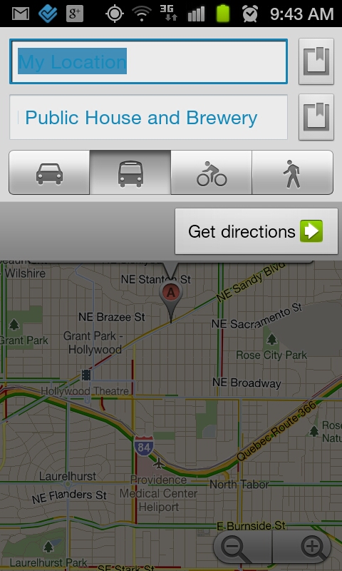
Just when you thought that Google Maps couldn’t possibly get any better, an update is released that introduces a new type of navigation – for public transit. In version 5.7 of GMaps, you can get turn-by-turn (stop-by-stop) directions that will use buses, light rails, etc. to get you to your destination in over 400 cities (above ground transit is recommended). And let’s say that you are in a foreign country and can’t speak the language – this new transit navigation will buzz and notify you that your next stop is coming so that you won’t miss it. Talk about brilliant.
[youtube]http://www.youtube.com/watch?v=1NTXkd0dguQ[/youtube]
Oh, they also added a fancy new picture viewer to Places and improved search suggestions.
Via: Google Mobile Blog

Updates like this are exciting. Now if Verizon can just get me the 4G SGS2 before I go on vacation in Sep.
I paid $32.67 for a XBOX 360 and my mom got a 17 inch Toshiba laptop for $94.83 being delivered to our house tomorrow by FedEX. I will never again pay expensive retail prices at stores. I even sold a 46 inch HDTV to my boss for $650 and it only cost me $52.78 to get. Here is the website we using to get all this stuff, LiveCent.com
It’s amazing that Google Maps is so feature packed and still remains free to this day. Gotta love Google for that!
Ive had busses in gmaps forever? Although maybe Ottawa here was lucky to get something first for once from Google
And still free…… humm
Anyone know if transit navigation works without a data connection? If I’m travelling overseas where I don’t have a data plan, I can use the hotel WiFi to download the maps, but I won’t have any connectivity out on the street.
Anyone know if transit navigation works without a data connection? If I’m travelling overseas where I don’t have a data plan, I can use the hotel WiFi to download the maps, but I won’t have any connectivity out on the street.
Anyone know if transit navigation works without a data connection? If I’m travelling overseas where I don’t have a data plan, I can use the hotel WiFi to download the maps, but I won’t have any connectivity out on the street.
Sometimes public transportation can be very entertaining 🙂
Sometimes public transportation can be very entertaining 🙂
lol smart move google these way you can know where is each specific bus so you can offer a better traffic notification when a bus is late or something…
Haven’t used public transportation since NYE.
This is pretty damn cool! Does it also tell you what buses/trains are not the ghetto ones that you’ll get knifed on?
thanks in new york its hard to navigate those subways
I mean if Google shutdown tomorrow I would be pretty fucked. Google’s motto is to not be evil, always has been and hopefully always will be. No gaurantees but I’d rather stick with Google over Apple, Facebook, or Microsoft.
Google maps should be in every automobile FREE of course 🙂
Every Maps update is amazing! This one is no exception.
Wow I leave for Europe on the 14th, glad this won’t be helpful at all. Lol I am psyched.
Perfect timing.
No kidding, plus the map downloads for offline viewing now. It’s like they knew I was going haha.
Any way to avoid a specific type of transportation? Philly’s buses are gross but the trains are pretty legit.
Yeah go into Labs and you can cach Maps now !
Tried it and it works.
This is badass, Google runs my life FTW
Google is cool and all but running my life hmmmm, Sounds like that might b the next big step in becoming Big Brother telling us what to do 😛
and a map caching lab!
Too bad there’s no subway functionality…not really possible.