Google Maps has always been an impressive app, particularly when it comes to helping you navigate to your next location. Today, they’ve made it easier to complete complex navigation requests for those who might need to combine transit with biking or ridesharing.
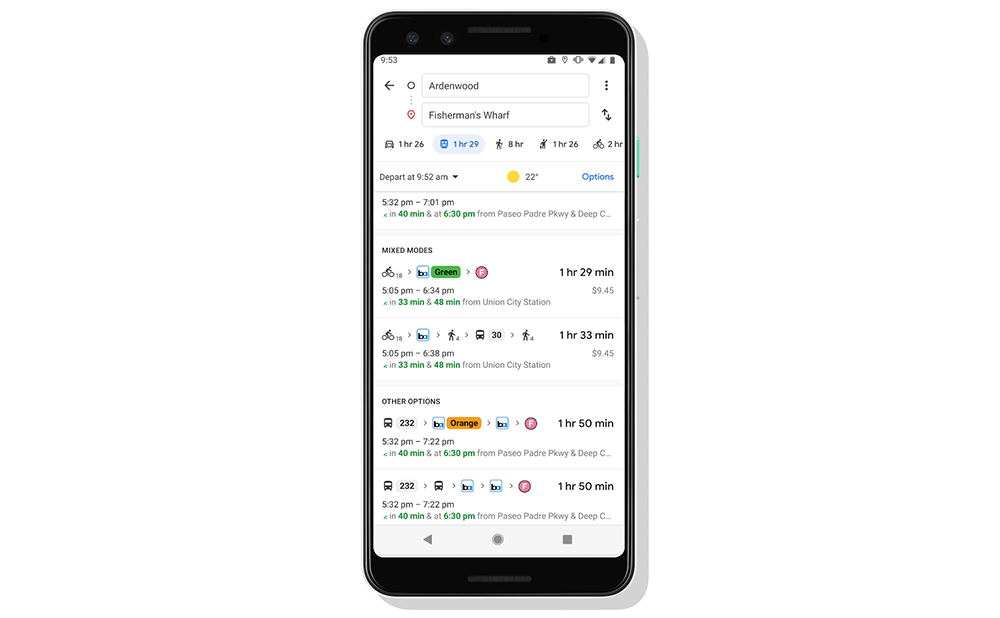
Starting today, if you are headed somewhere that requires a combination of travel options, Google will show you those in an easy-to-digest format.
Specifically, if you need to bike or rideshare to a transit stop before jumping on a bus or train, Google will give you the best options, breaking down pricing or time-to-wait too. Each leg of your trip is separated out, you’ll be able to choose your rideshare platform of choice, and clearly marked ETAs are there at every point.
To get started, enter your location in Google Maps, tap on the “Directions” button, choose transit, and then scroll through the list of available options that may include biking or ridesharing.