Google Maps is picking up several new features to help with one of the weirdest holidays seasons we’ll likely ever experience. Google has plans to help you find even more info about COVID in your area, see how crowded your bus or train might be, and track all of those takeout and delivery orders.
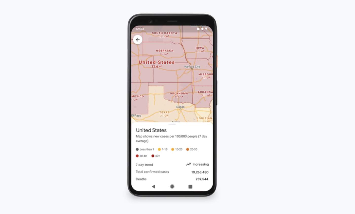
The newish COVID layer in Google Maps will soon show all-time detected cases within an area, plus there will be quick links to COVID resources, including local guidelines, testing sites, and restrictions. This could all be super handy for those traveling out of town to new places during the holidays.
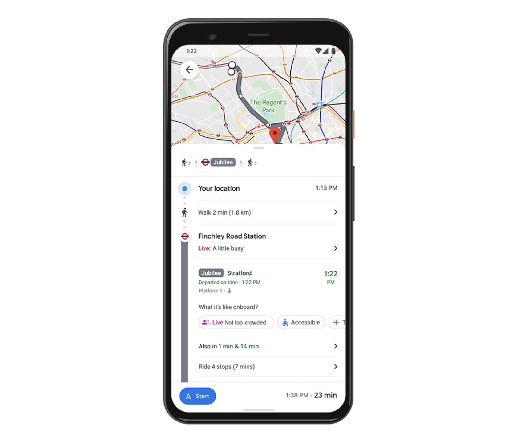
For those who take public transportation on the regular, Google is about to show you (above) how crowded your bus, train, or subway line is in real-time. Using Google Maps info from users around the world, your transit instructions could tell you the level of busy going on and if that next bus is safe to ride on.
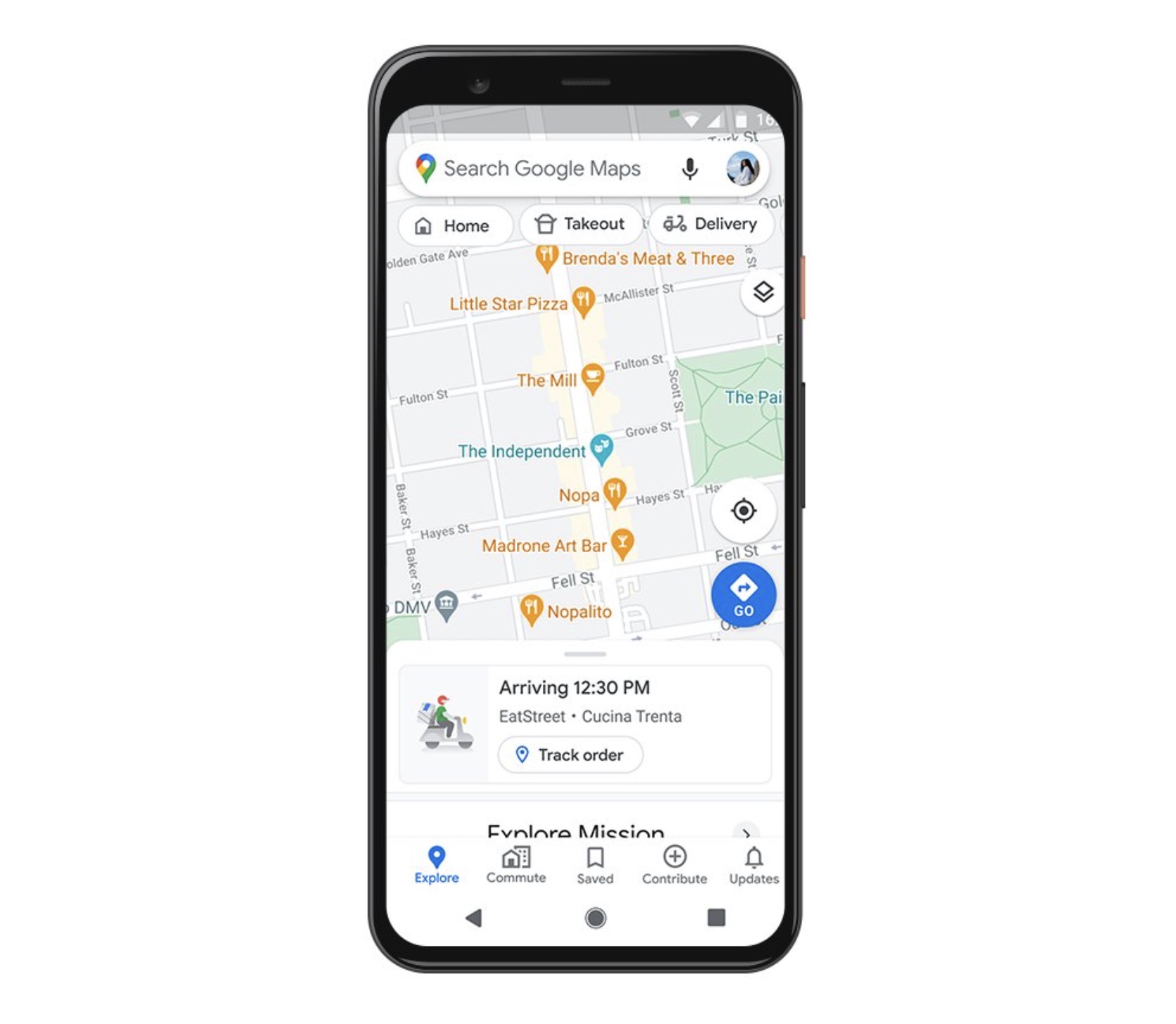
And finally, for those planning to order takeout as we lock back down across the globe, Google Maps will be able to show you (below) when your food is ready for pickup or how close it is to arriving on your doorstep. Google will also include expected wait times, delivery fees, and let you re-order your favorites.
I’m curious to see how this will work, knowing that there are dozens of delivery apps already on the market. Will Google tap into those, partner with select services, that sort of thing? We should know soon enough.
Google says to expect these improvements in the “coming weeks.”