Google Maps is seeing an update today (v8.0.0), one that Google seems proud enough of to give us a changelog for already.
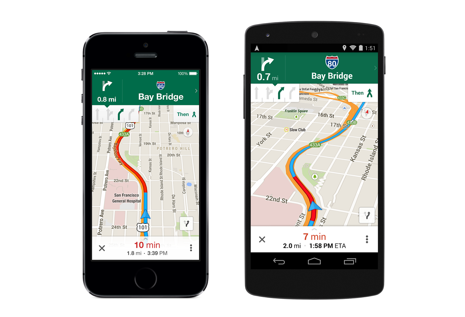
Thanks to the update, you will now see more information during turn-by-turn navigation, like distance, arrival time, and quick access to alternate routes. You will be able to save and manage offline maps in a custom list for when you are traveling, see total walking time in transit directions, and be able to launch Google Maps if you have Uber installed. Oh, they also tossed in an option to see “Places to review” for previously searched-for place if signed-in.
The update is slowly rolling out as build 8.0.0. We will try to get a download for you. Edit: Download below.
- Turn-by-turn navigation now displays distance, arrival time, and quick access to alternate routes
- Save and manage offline maps in a custom list for when you’re traveling or have a slow connection
- Transit results now display total walking time of your trip and the next scheduled bus or train
- Sign in to see your “Places to review” list from recently saved or searched-for places
- If you have the Uber app installed, open it right from Google Maps when comparing route options
- Bug fixes
Play Link | Download [2] (apk)
Update: Google posted additional details about the 8.0.0 update to their LatLong blog. Here are the major points –
- Lane guidance: The Google Maps app now shows you which lane to stay in or move to so you’ll never find yourself driving for miles down the wrong road. You’ll also have easy access to alternate routes while you’re navigating, so you can choose the best drive for you. Lane guidance is available throughout the US, and in parts of Canada and Japan.
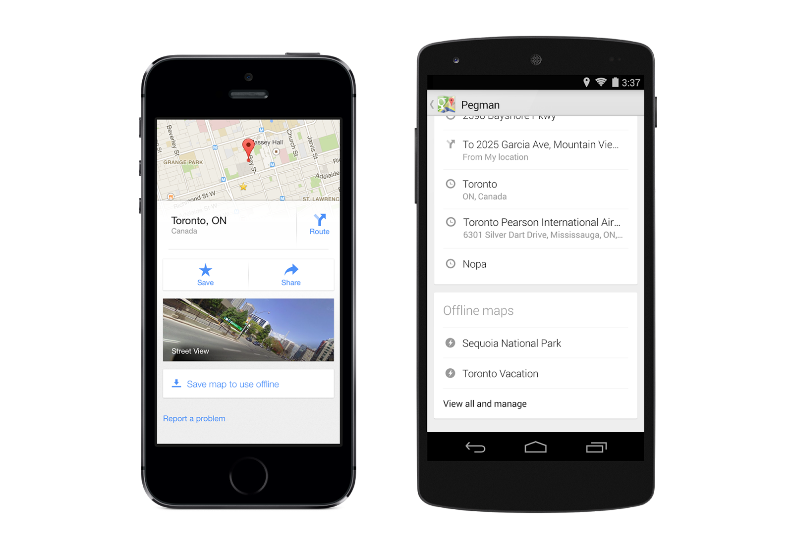
- Offline maps: Before setting off on your next vacation, hike, or roadtrip, search for an area and tap on its place info sheet, then when available, you can select “Save map to use offline,” and give your map a custom name, like “Toronto Vacation.” To find your offline maps, sign-in, tap the profile icon next to the search box in the top right corner, and scroll to see “Toronto Vacation” and other saved maps.
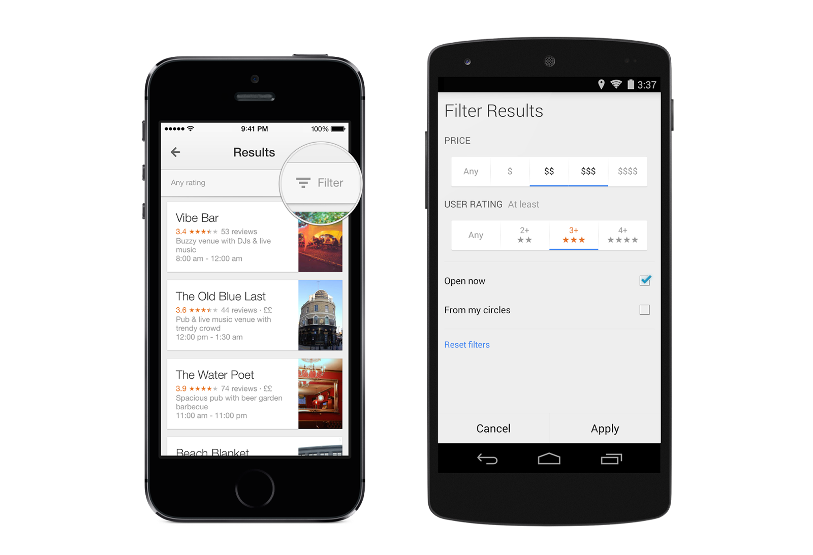
- Places filters: With new filters, you can browse through restaurants, bars and hotels by opening hours, rating, price, and more—where available—to find just what you’re looking for, right when you need it.
- Uber connection: Frequent Uber rider? If you have the Uber app installed, you can now compare your ride with transit and walking directions right from Google Maps in some cities. And if you choose the Uber option, you’ll jump right into the Uber app with just one click.
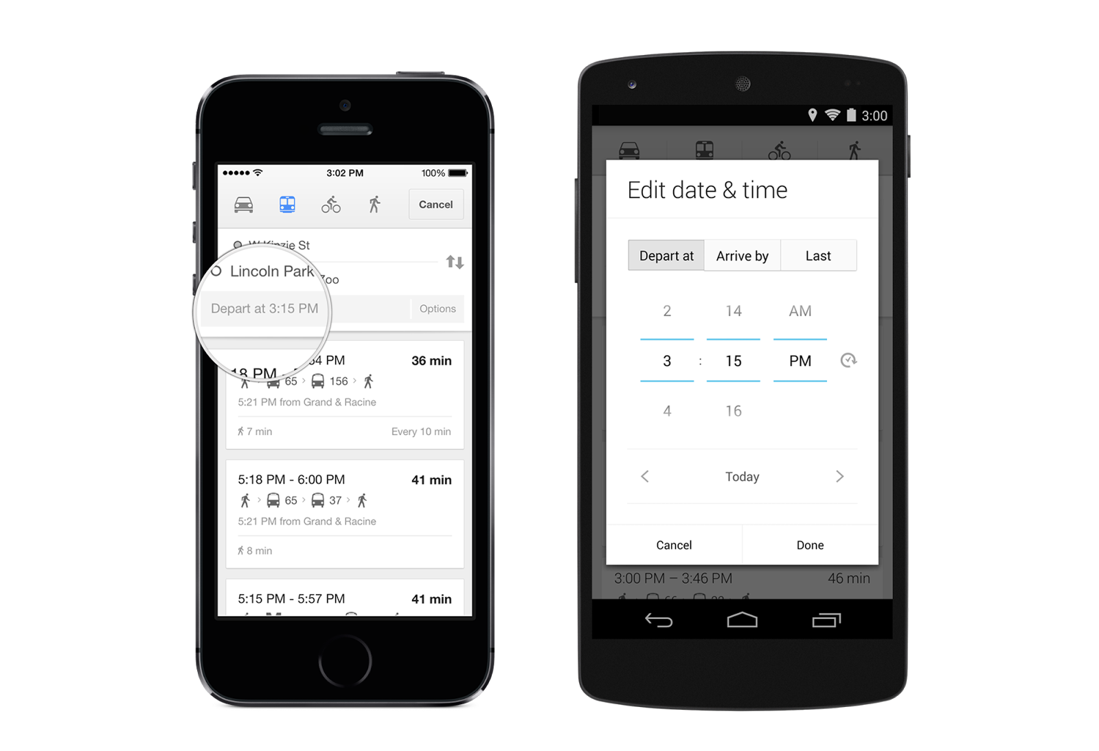
- Better transit info: With more than a million public transit stops on Google Maps, you’ll get reliable information to help you get where you’re going. Next time you’re in Chicago, search for directions to Lincoln Park Zoo, tap the train icon, and select “Depart at” to choose the time and day you want to leave—or even “last train home” for those night owls—so you get the most accurate transit information for your needs.
- Favorite places: See places you’ve saved on Google Maps across all your devices when you’re signed in. And if you find a place you want to save on the go, search for the location you’re interested in, tap on the place card, and hit the star icon to save the location for later.
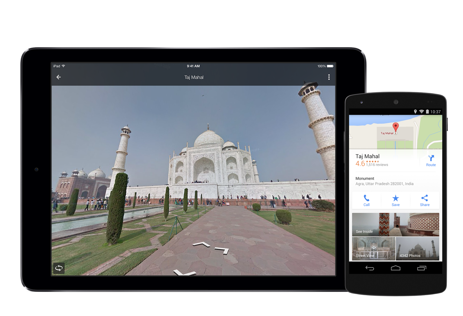
- More Street View: Search for your ideal destination—anywhere from the Gateway Arch to the Taj Mahal—then tap on the place card to dive into Street View where available. You might even get a peek inside some hotels, restaurants, and more.
Collapse Show Comments128 Comments