Google announced updated satellite imagery for Maps and Google Earth this week, courtesy of the USGS/NASA Landsat Program. Using HD images from primarily the Landsat 8 satellite, these images feature greater detail and truer colors, offering a better look at a cloudless Earth.
Not only does Landsat 8 provide better photos than Landsat 7 (which most of Google’s previous images were compiled from), but the sensor also snaps shots twice as fast. This allows Google to provide the most up-to-date look at our planet from the sky.
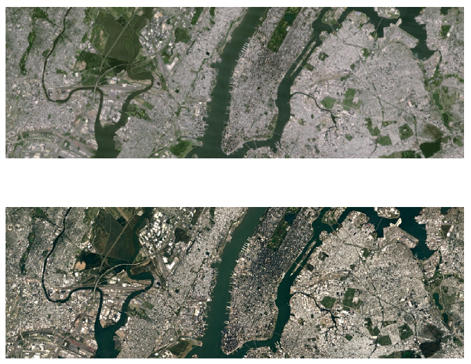
As users will note, at certain altitudes, images will be much more clear. For example, in the shot below, skyscraper details and shadows can be made out in New York City, as well as a superior details in Central Park. Landsat 8 images have been applied across the board, meaning that in most cases when in Google Earth, you will be viewing high-quality images with more detail.
To enjoy the updated mosaic, open up Google Maps (Google Earth) on any platform, then enable the satellite layer.
Above is Before, Below is After
Collapse Show Comments9 Comments